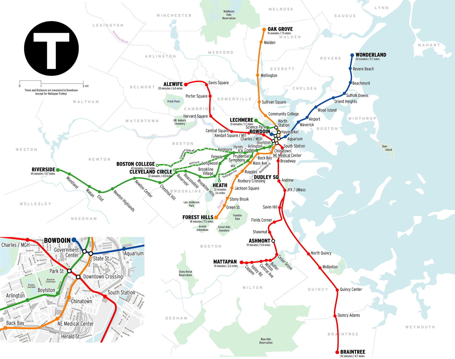
Routes: Red, Mattapan, Orange, Green, Blue, Silver
Red: Heavy Rail – Alewife – Braintree/Ashmont
Length: 33 km (14 km underground)
Number of stations: 22
Orange: Heavy Rail – Oak Grove – Forest Hills
Length: 18 km (3 km underground, 7.5 elevated)
Number of stations: 20
Mattapan: Ashmont – Mattapan
Trolley service. Shown on some maps as an extension of the Red Line and is similar to the Riverside Branch of the Green Line.
Green: Light rail – Lechmere – Boston College/Cleveland Circle/Riverside/Heath
Length: 36.4 km (7.2 km underground, 1.2 km elevated)
Number of stations: 65
Blue: Heavy Rail – Bowdoin – Wonderland
Length: 9.5 km (3.4 km underground)
Number of stations: 12
Silver: Washington Street Corridor & South Boston Piers Transitway – Logan Airport
For more information, visit http://www.mbta.com and http://mbtaviz.github.io
Entrances and Exits per station in February 2014
Source: Visualizing MBTA Data at http://mbtaviz.github.io

